Your adventure, your way, with Canyonlands Jeep Rentals.
Rent a Jeep or Car to explore all the beauty Moab has to offer.
Moab Jeep Rentals
Start your Adventure with a Moab Jeep Rental
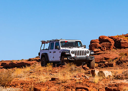
Planning an adventure in Moab, Utah, and looking to explore its iconic red rock landscapes behind the wheel of a Jeep Wrangler Rubicon? Canyonlands Jeep & Car Rentals offers a variety of Jeep rentals in Moab, perfect for conquering Moab's legendary off-road trails or cruising scenic dirt or paved roads. Whether you're an experienced off-roader or a first-time visitor, Canyonlands Jeep & Car Rentals has the perfect vehicle and the expertise to help you create a memorable Moab experience.
Rent a Jeep Learn More >Moab Car Rentals
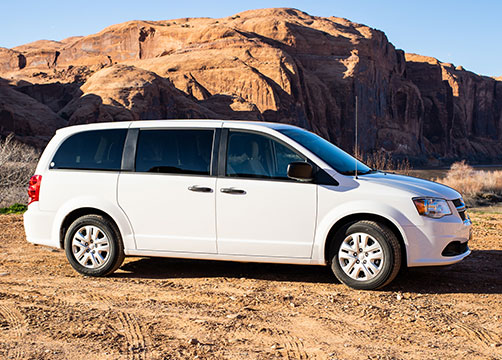
Not wanting to go off-road? We have great prices on car rentals too!
If your adventure is sticking to paved roads and you are looking for a car rather than a Jeep you have come to the right place. Our fleet ranges from compact cars such as a Honda Civic, the midsize Toyota Camry, small SUVs Hyundai Santa Fe or Jeep Grand Cherokee, and Honda Minivans. If you have a large group or family with you we also have a couple of 8-passenger SUVs and 15-passenger transit vans.
Rent a Car Learn More >Customer Testimonials
Read what our customers have to say.

 Adam R
 Selina C
 Katie C
Unlock Moab's Hidden Gems with a Jeep Rental from Canyonlands
Sun, fun, exploring, and making memories. Some things are just better in a Jeep! Canyonlands Jeep has a fleet of new and modified 4x4 Rubicons with Bestops Sunrider tops. The Sunrider is easy to use and convenient for a quick change to an open-air vehicle, which is one of the best ways to see the views from the trail. Discover the freedom and capability to explore beyond the pavement, reaching hidden arches, breathtaking viewpoints, and secluded canyons that Moab is famous for.
Rent a Jeep Learn More